1959 - 2007

This site is not affiliated with any religious organization or denomination.
Ancient lands of Nanatsoho
and Nashit'ush
Original land of the Caddos
Indian Territory of the Choctaws
Shawnee Hills
Tobucksy County- McAlester
Township of Bucklucksy

Featuring significant history of Lake McAlester (McHoma) and an overview of Chaote Prairie.


The Camp Hudgens Experience Series
UPCOMING EVENTS
2015 for The Camp Hudgens Experience was at:
Camp Tulakogee, Fort Gibson Lake
see photos below the 2014, 15 secton.
Campers experienced the core Camp Hudgens program.
Campcraft, Riflery, Archery, Cookouts
Crafts, Nature, Map & Compass, knife safety,
.
Vespers, missions, boating, swimming in the creek.
Ropes course, climbing wall, nature hikes, field games.
You almost felt like you were back at Hudgens in the 80's again.
Two full days of activities brought back the boys camp experience.
This is an RA camp, yes, a Royal Ambassador camp you have been missing for more than 15 years in Oklahoma.
Some of the old time activities
Reveille
Flag Pole with RA and US pledge
Breakfast
Am skills
Lunch
Pm skills
swim in creek
concessions/store
Supper
Group games
Lower flag
Vespers
Evening worship
Concessions
Dorm devotions
Taps


2014 camp photos


Camp Tulakogee ---->

2015 H/X Photo Montage
The 2015 H/X Experience at Fort Gibson Lake
 Tulakogee-2.jpg |  36 hole mini golf. |
|---|---|
 The twin engine passenger planeThis is the crafts hut. |  Peddle cart track |
 Me (Mark) at crafts |  The new conference center hall |
 The activities room |  2015-07-23 19.21.31.jpg |
 The old twin passenger plane |  The ampitheatre that faces lake |
 An 1890 home in Wagoner |  The train engine at entrance |
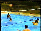
 On the peddle car track.This was a favorite activity |  The pool slide.You get an enema on the splash down |
 The conf. hotel room with 4 beds.This is very nice accommodations. |  Sassafras plantThe kids liked smelling the root for the root beer. |
1983 Camp Hudgens 8mm
First rope bridge over creek The Temple of Silence
That's right, the property transferred from the Choctaws to the City of McAlester and then to the Masonic order for the purpose of a girl's camp. They named it Rainbow Gardens which explains the plethora of original gardens that existed at the time the Baptists bought the camp. Through the years, the caretakers removed some of the garden spots and stone walkways because of construction or maintenance issues. It is often hard mowing around the stone paths so a lot of them were removed.

This ropes bridge was at the creek west of the waterfront. It was very near where I built my cable bridge and was the inspiration for same. This was a three rope design.

If you don't recognize this building it was last used (until 2007) as the missionary quarters. We used it as the health center but between 1959 to 1973 it was the camp administration building. The Rainbow Girls used it as their office. The roof was a dance floor for the dances with the Demolay boys (which is Camp Craig). This building had five rock pillars on the east side. Each pillar had flower boxes for the flower that represented the Biblical matron each girl chose to follow: Adah, Ruth, Esther, Martha, Electa. A massive marching stone trail system tied this building to the old dinninghall, pool, and prayer garden.

Temple of Silence Game
1939 Aerial of Rainbow gardens

You've been tasked to go from the old Mason built Health Center to the concession stand. You pick up a jet pack and go through the old center. Avoid bats and plasma hatches on the way.
Tap on the button to play game--->>>>


I bet you didn't know it started as Rainbow Gardens
In 1940, the area just south of camp was called Bucklucksy. As you can see the road toward the lake is about the same. But what is that road that appears to run right through the middle of the camp property? I think its the wagon trail that would have gone from the front entrance down to the creek, then back to Unit III and out to the west of camp.


The Oklahoma State Board of Public Affairs Built Lake McAlester in 1920.

The State Board of Public Affairs built Lake McAlester in 1920 and was granted power of imminent domain. See the story on the PROJECTS page about the lady who sued because she lost 330 acres.
Original Rainbow Girl marching trails.
Mainly for ceremonial purposes as they work toward their advancement goals. There were once 5 pillars east of The Temple of Silence below. They removed the two that were not in good shape and used the other three for the rain porch. Bro. Paul would line up chapters on rainy days for daily muster. We then had morning announcements and then went to breakfast.


Bible Flag Constitution Lambskin
According to a lady who works at the Rainbow Girls, the above seal was once in the old administration building. I can say for sure it is not there, not even under the tile. Evidently Bob had it totally removed. She also said that there was a rock foot bridge that had the above seal on it. I never found that bridge. I may have been over the koi pond, which had been removed also by Bob.


Marching orders


1893 Mcalester area..


I will tell you an ages old secret about Lake McAlester. Using this map, you would be able to compare to a modern day topo map and draw in the exact location of Bull Creek, which is under Lake McAlester. You can also locate the creek that runs right through the middle of camp's property. The secret is used by local fishermen to catch some of the largest channel cat in this part of Oklahoma. They prowel the old creek beds.
Choctaw Coal and Railway Company camp on the Canadian river. This woud have been located not too far north of camp along the Canadian river. This was circa 1870.
F.Y.I. Indian Baptist came first.


1962 Hudgens & Lake
In 1962, 45 acres was just a postage stamp. But by late 99, Hudgens owns nearly all of the land that you see in this photo on the right. Below is the bulk of the original land. There was a very small out parcel for the bend in the road that was purchased from the Powell family. The farm road running through to the west ended at the creek and the primitive unit would be there for many years. The pond you see in the top left was off camp property and only a small amount of waterfront was actually owned by camp. They later built the docks and the boathouse.

Not quite as famous as the Chisolm or Yukon trail, the Scipio trail was a wagon route from Scipio to McAlester. It went through the north part of Hudgens property and to the lake which did not exist at the time. For many years, the trail was a guide through the land that had no other trails. It still had the wagon ruts for many years although a dozer operator drove over much of it to make a wider trail for Unit III. Some of the wagon ruts exits in the area known as the rocky flats. There was also a cattle trail from the old Weeks property to the west. There was a farm house long ago near this cattle trail that is long gone. The dozer wiped out the old wagon ruts on that trail also.
An early staffer told me that he found evidence of the Indians that once occupied this Land of the Choctaws. This included arrowheads and possible burial mounds. I have found evidence myself ot he burial mounds myself in the far Unit III area. I camped out a good portion of my youth in Unit III. I rarely ever camped ouit near those mounds. No particular reason except that it was so heavily wooded it was always hot. I chose to camp out closer to the lake where the north face would catch a lot more wind. It was always cooler camping out toward the northeast section of the Unit III land and catch the evening winds.


You can see the wagon ruts in close detail by this image on the left. THis was not created by anyone at camp because this area was not developed or used by the city prior to selling it to camp. It went from the Tribe, to the city, to the camp. This is an authentic wagon trail of late 1800's creation.

The BGCO does not own this 16 acres of land that sits northeast of the waterfront. Old Unit III dock is seen at the base of the parcel. This land is owned by a family who lives in California. The legal description mentions a line going true north of Camp Craig dinning hall northeast corner and dissecting the land from lake shore to lake shore. Can't tell you how many times we camped out on that point because it made good cross wind. We would park the boat at Unit III dock which curerntly sits on this guy's property to this day.


I found this McAlester area Indian Territory image. It peaked my interrest because right away it looks like it could be looking to the east from widowmaker's cove. That's because the mountain formations looking that way are correct, then the plateau where the bottom of the lake would be now and then Bull Creek, which made Lake McAlester. Even the trees of widowmaker's cove are there. Camp Hudgens Unit III would be the patch of trees you see on the far right of the photo. Without any documentation, you can let me imagine.
1857 Indian Territory map
Camp Hudgens is in the area known as The Shawnee Hills. In 1857, the area was known as Shawnee Villages. They very likley were spread out on the plateau where the lake is now. As mentioned before, Bob Gilmore found Indian artifacts in his early 1960 exploration of the areas of camp. This includes arrowheads and tomahawks. The red dot on the map in the "O" is where I believe Hudgens is now. Its hard to do cartography with such an old map. But by comparing modern day map locations of the key waypoints, I came up with that location and its consistent with other maps. You can see it is located near the former Shawnee Villages. This was way before the establishment of McAletser. I also mentioned that Bob believed the mounds found in the north Unit III area could be Indian burial mounds. I concure and have found several mounds in my hikes at Unit III. It had a lot to do with my choice of places to camp out with Unit III campers. I would not want to camp out on a burial mound. I made sure to camp out toward the north side or lower on the Northeast side where the winds were good in the late evening

This is the thought process for the 1857 map above. This more perfect, modern map shows an almost equalateral triangle. The map above is not so perfect but I think its right. Because there are no other creeks running into Coal Creek that would have warranted moting on such a map in 1857 except Bull Creek, the main source of Lake McAlester. So on the 1857 map, I had to place Camp Hudgens west of that creek line because there are no other creeks flowing into it going east from that point.. So the fact that the map above is so different than 2013 is most likely ancient map methods.

Baptist Station - 1872.

Future sit of --------->
Lake McAlester and
Camp Hudgens.
How many of you good Baptists ever visited the first Baptist establishments in Choctaw Indian Territory? It is now known as Choate Prairie Church and its still standing. Camp Hudgens caretaker Lloyd Ellis was a pastor of it in his later years at camp. We visited his church just about every Sunday.

In The BeginningTitle.


James C. Choate owned slaves and a plantation, and ran an inn on the Natchez Trace. The family did not come to Indian Territory with the Removal. Instead James C. with his two remaining wives and some of his children came to Indian Territory (2) in 1854 settling on the land that later became a community bearing their name: Choate Prairie, near the present community of Indianola, Pittsburg County, Oklahoma. It is known that Samuel, William & John came to the territory as did others of their siblings. Christopher Columbus Choate, a Mason, and well known in McAlester, was a son of Samuel Choate, George Washington's brother.
Choate Prairie Church was founded by Eliza Wade Choate (grave on the right). She formed it as a Baptist Station mission of Indian Territory. Her home is listed on the National Registry of Historic places (shown below). It is in the nearby town of Indianola. Her husband George W. Choate, was a pioneer Tobucksy County Judge and a member of the Choctaw Supreme Court.


Another Choate Family home.


George W. Choate home
This is called Zion Church Settlement School in 1889. It was 10 miles west of McAlester. It was attended by Choctaw students and taught by Mary Elizabeth Piepgrass Choate. Daughter of Eliza Choate mentioned above. Her husband is William F. Choate. Mary Choate was also the first post master of the town of Choate Prairie.
Bud and Judge George Choate, 1904
Were these the first real Sooners?
According to federal law and the Doak Settlement Agreement, you had to have tribal permission to occupy land owned by the tribe. There is no record in the Dawes Rolls or other tribal land records that the Choate family had any tribal title to the land. Choate Prairie was a buffer zone between two peaceful tribes of the Creeks and Choctaws. The Creeks were just north of the S. Canadian River as that was their way, to live near a creek. The Choctaws owned everything from the S. Canadian River to the Red River. They were in good graces with the Choctaws because they built the school featured on the right as a Choctaw school. You can even see Mrs. Choate and some of her pupils.


Why leave Falls Creek and seek out a new location for the Royal Ambassador Camps?
Why did they want to leave Falls Creek and seek out a new location for Royal Ambassador camps?
Oklahoma Royal Ambassadors goes to Brotherhood 1955


1949 State Camps
The state camping program for our young people brought together some 604 young people in our state. We had five state camps.
Intermediate Royal Ambassador Camp with 68 enrolled; Junior RoyalAmbassador Camp 161; Intermediate Girls' Auxiliary Camp 89;
Young Woman's Auxiliary Camp 90; and Junior Girls' AuxiliaryCa,mp 196. These camps were held at Falls Creek assembly grounds. This year was the first time we had had an Intermediate Royal Ambassador Camp.
Footnote on Nunny Cha Ha


RECOGNITION SERVICE . . . Surrounded by RAs is Bob Banks, state RA secretary, who directed an RA recognition service at Immanuel Church, Shawnee recently. Eighteen boys were recognized for the work they had done.

1st Baptist Royal Ambassadors BB team - 1967
front row: Richard Sherrill, John Flippo, Robert Allen Schwartz, 2nd row: Melvin Ernest; David Taylor; then Steve Hobbs; Mike King; Jim Henson (NHS jacket)
1950 RA Report
An R.A. is auctioned off to show value of life.out you.

DEDICATION 1954» .. On Sunday afternoon, Aug. 1. dedication services were held for ihe campgrounds (Nunny Cha Ha) on which Woman's Missionary Union of Oklahoma plans to build a new youth camp* Thesite is atop a mountain on ihe Falls Creek Assembly grounds. Taking parr in ihe services were(left to right) Mrs. Karl Moore, Ardmore, chairman of the building committee; Miss Margaret Hutchison, state WMU executive secretary; Mrs. C. A. Summers, Muskogee, state WMU.
Don Trotter was introduced as the auctioneer in a playlet,
"The Value of a Boy" produced by the Tulsa Immanuel Royal Ambassadors and Brotherhood. Parts in the playlet were taken as follows: War-.Joe Timmons; Crime-Dale Scott; "Commercial Amusement-Ivan Thompson; Movie Industry-Richard Caldwell; Liquor Traffic-Joe Gahm; Missions-Dorris Dean McInnis; W.M.U. -Ann Thrash; R.A Leader-Tom Canafax and the Boy AuctionedTeddy WlIkInson. Mrs. O. L. Baker was director of the playlet.
State Camps
Our state camping program brought together 589 young people in our state. We had five state camps at Falls Creek; Royal Ambassador Camp with 204 enrolled; Intermediate G.A. Camp with 69 enrolled; Y.W.A. Camp with 67 enrolled; Numher 1 Jr. G.A. Camp with 129 enrolled; Number 2 Jr. R.A. Camp with 120 enrolled.
Living for a week with missionaries and other leaders certainly helped our young people to "look on the fields that are white unto harvest."st."
An account of the first summer at Camp Hudgens
Opening year difficulties—yet five successful weeks of camp were held at
Camp Hudgens this summer. Lack of water, cooking equipment and tents greeted
the first campers at the state Royal Ambassador camp near McAlester, but before
the last week was over the equipment had arrived and a water filtration system was
in operation. A spirit of pioneering prevailed in all weeks of the camp with camp-
ers and staff helping to clear trees for electric lines, paint the buildings, clear brush
from the central area, build tent plat-
—
A total of 426 attended the five weeks
of camp. This number included 326
campers, 87 staffers and* 13 counselors-
in-training. Public decisions totaled 59
which included 10 professions of faith,
19 rededications, and 30 for church re-
lated vocations. Twenty-four associa-
tions were represented in the camp at-
tendance.
"I enjoyed the camp in spiteof the lack of facilities. This is a new
camp. It has wonderful possibilities. This
will be one of the South's best'RA camps
in the years that lie ahead. You have
one of the finest camp sites that I know
about I am one of the operating com-
mittee of our district camp on Lake
Ponchartrain, near Mandeville. I visit
camps often but your organization and
Baptist men respond to the need.
Royal Ambassadors is a missionary
organization for boys. The RA move-
ment offers to the boy adventure in
Christian experiences and in boy-cen-
tered activities.
The theme for 1960 is "increasing
RA membership." Suggested plans for
member enlistment have been sent to
RA leaders. More copies are available
set-up was a bit different. It was re- from RA office.

Thank you Dr. John Pennington for your vision and your wisdom in approving the purchase of Camp Hudgens in a time when there was much resistance ot it at the Baptist Building. It was a good decision and served the Lord well.


The shield stands for faith in Christ (see Eph. 6:16). This symbol represents the journey of faith and a commitment to having faith in Christ.
The crown stands for Christ the King and what He represents (see Jas. 1:12). As a follower and ambassador of Christ, we are to stay focused on Jesus and His message to the world.
The branch is for achievement and victory in the work of being an Ambassador for Christ (see Matt. 25:21). Combining skills and actions help accomplish the goal of carrying the gospel to people needing to hear it.

Random bit of info you may never use.
The logo on the right is
1) Extra great RA.
2) Embassadore Royal of Brazil.
3) Expert at Royal Ambassagors.
Move mouse over buttons to reveal a sub-menu.